Research in Michigan
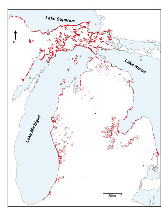
| My research focuses primarily on the interior of Michigan and along the shore of Lake Michigan. As indicated in the right-hand figure, dunes are quite common throughout the state. The purpose of this research is to relate the mobilization of eolian sand to paleoenvironmental changes such as lake-level fluctuations, fire, deforestation, and deglaciation. Support for these studies has come from a variety of agencies, including the National Science Foundation, the Michigan Departments of Environmental Quality (Coastal Management Division) and Natural Resources (Parks and Recreation Division). |
|
Interior Sand Dunes
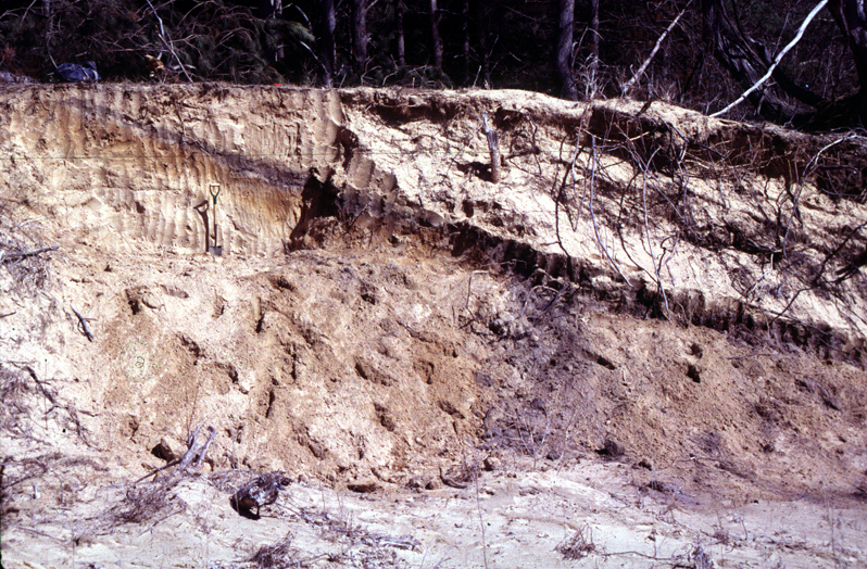 |
| NSF sponsored a research program that focused on the geomorphic history of sand dunes that occur within the interior of Michigan. These dunes must have formed sometime in the postglacial history of the region; thus, they must be younger than ~ 13,000 years old. At first glance, it would appear that the dunes must have formed immediately following deglaciation, as that is the only apparent time in which vegetation was sufficiently sparse to allow eolian sand mobilization to occur. Radiocarbon and OSL dating indicates, however, that the history of these dunes is more complex. Interior dunes in ower Michigan last mobized ~ 10 ka, whereas those in upper Michigan were last active in the middle Holocene ~ 7ka. As the paleosol in the figure below illustrates, some dunes were active more than once. Overall, these results indicate signficant mobilization of eolian sand occurred long after deglaciation. |
|
|
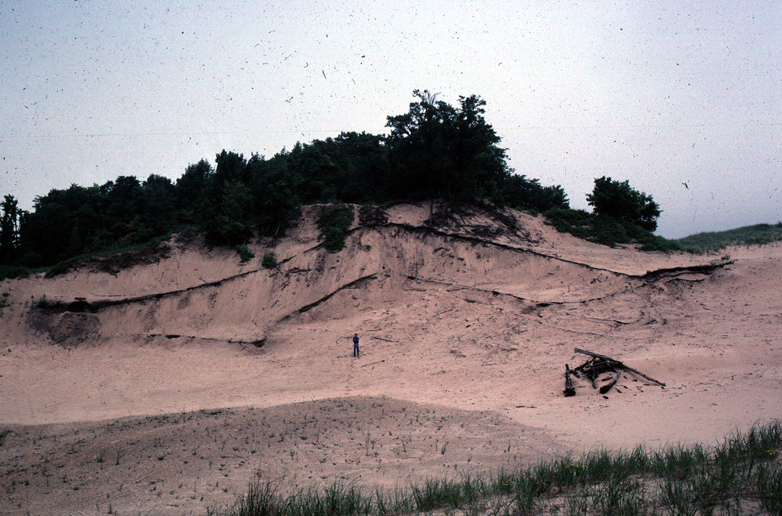
Coastal Sand Dunes
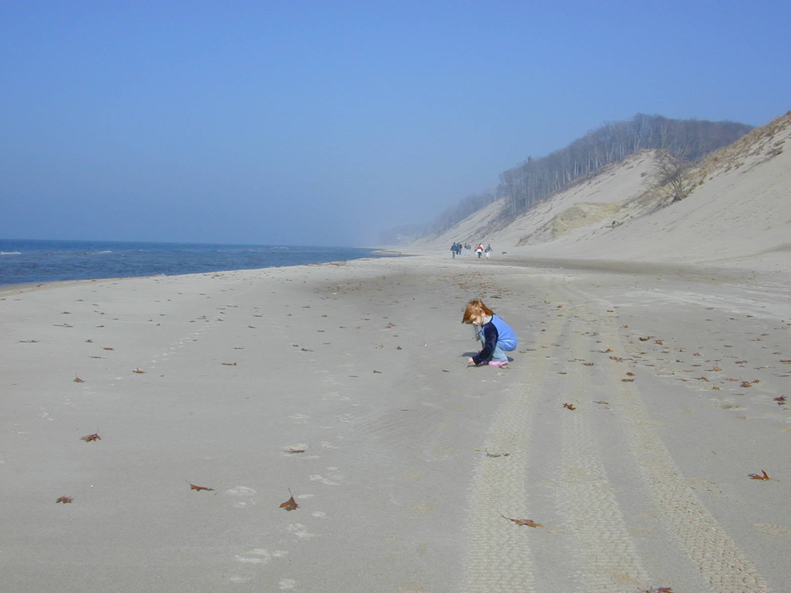
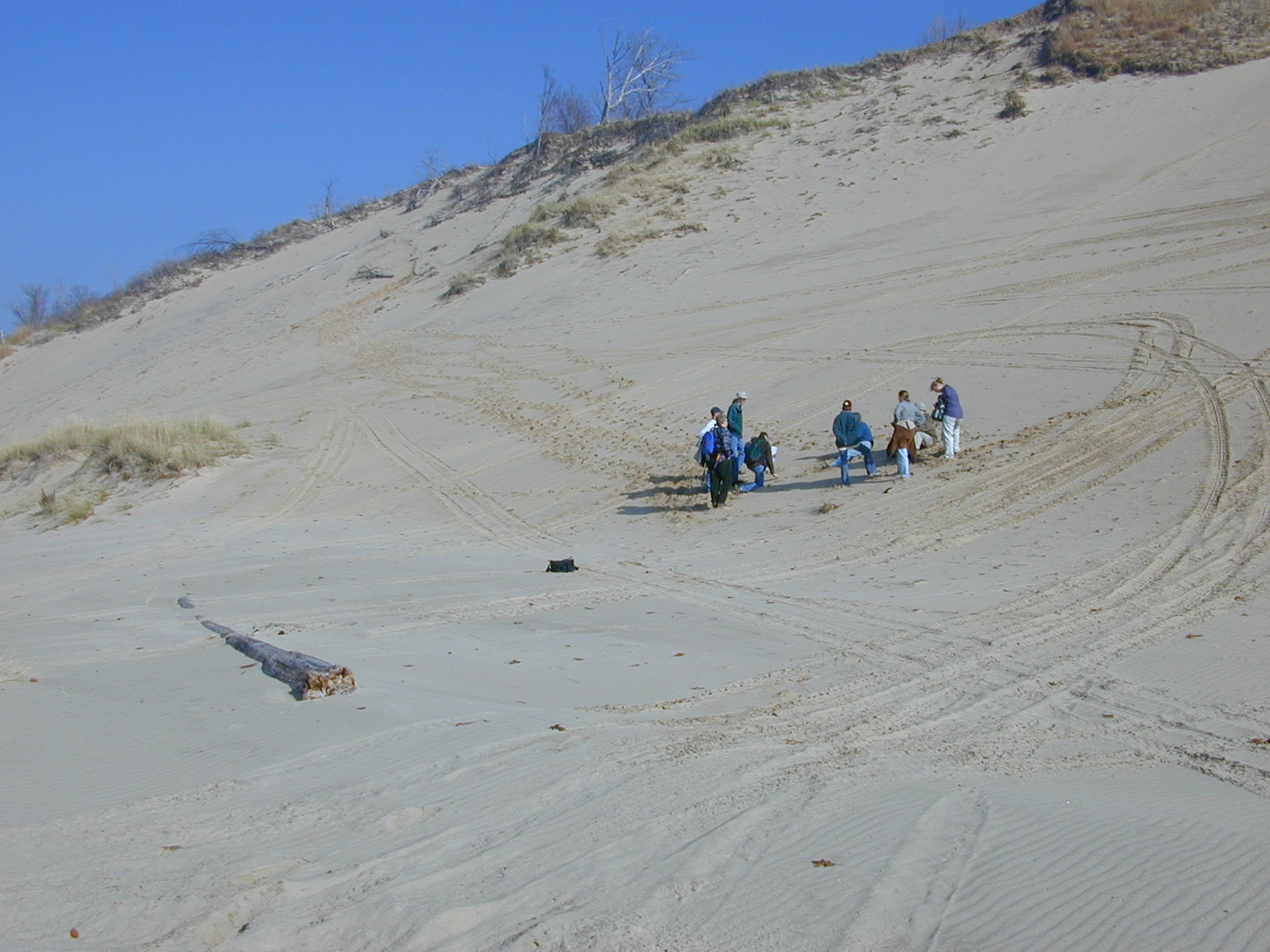
| Although sand dunes are common in the interior of Michigan, the most spectacular and best known dunes occur along the shore of the Great Lakes. Of these, the best developed dunes are found along the eastern shore of Lake Michigan. The image below left shows the relationship of the dunes to the lake. These dunes have historically been the source of much interest, but very little is really known about their evolution. The MDNR and MDEQ have funded several studies which have focused on reconstructing the history of the dunes in an effort to see if correlations exist with lake level. Additional support has come from NSF. The middle image below is a magnificent crossection at Ludington State Park, which shows a variety of buried soils. A basal date of approximately 3000 yrs B.P. was acquired from this site. The image to the below right is from the massive parabolic dunes near Holland. Here, the dunes are over 40 m high and are less than 5000 years old. |
 |
 |
 |
Research in Great Plains
| Once upon a time, I spent a fair amount of time working in the Great Plains region. This work was centered on the history of eolian sand mobilization in south-central Kansas, and was an extension of my graduate research that was conducted at the University of Kansas. |
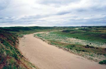 |
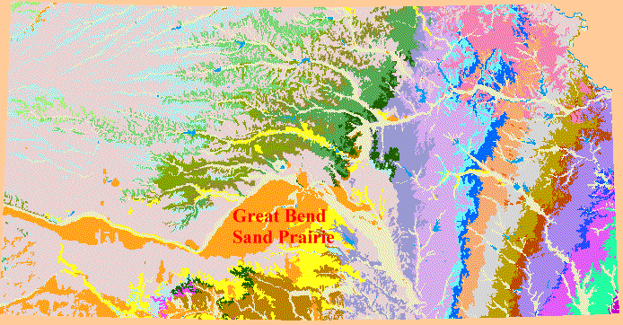
| The Great Bend Sand Prairie is located in the south-central part of Kansas. This region is bordered to the north by the Arkansas river, which apparently has been the source for eolian sand in the region. There are a variety of landscapes in the region, ranging from level plains to well developed parabolic and subparabolic dune sets. To see a representative landform map of the region, access this site. |
 |
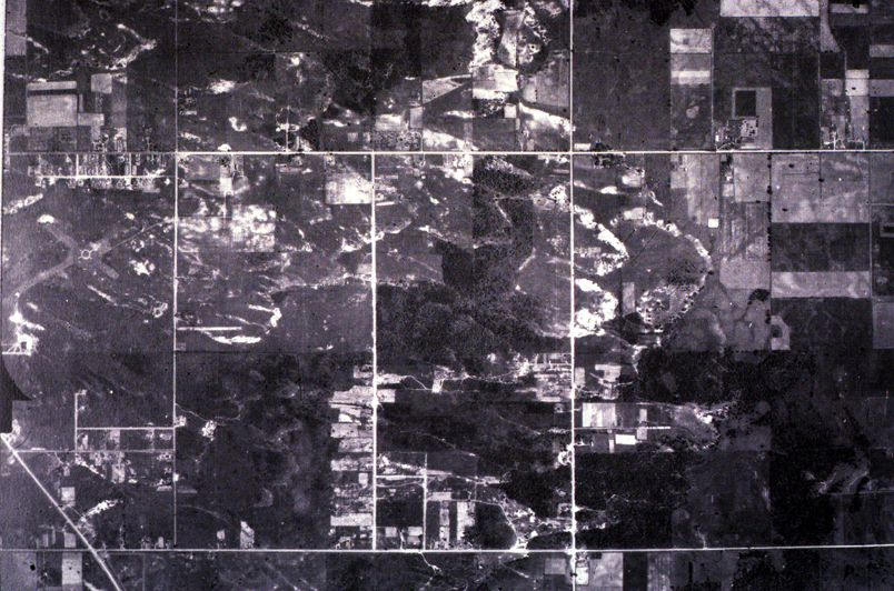
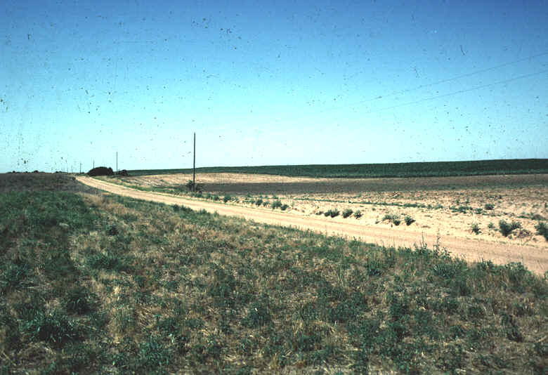
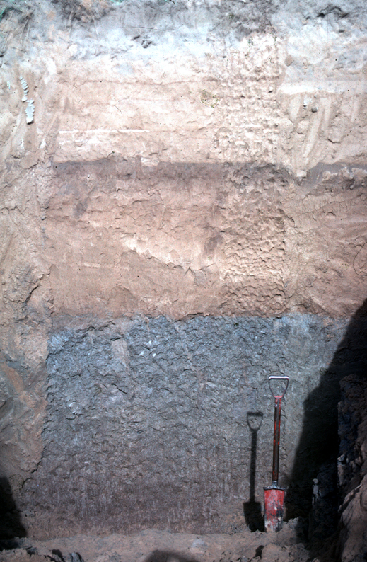
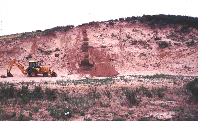
| The late Quaternary stratigraphy of the Great Bend Sand Prairie is essentially dominated by two pedostratigraphic units. The lower one consists of a poorly sorted unit of silty sand overlain by eolian sand. The silty sand is alluvium that dates to the late Wisconsin. The eolian sand is late Holocene in age, and usually contains one or two weakly developed buried soils. In the image to the right, the alluvium crops out in the center of the field (the dark area), and is covered by wind-blown sand in the surrounding (lighter) areas. In the image directly below, the basic stratigraphy of the region is shown in section. The basal (gleyed) unit is the late Wisconsin alluvium that dated (at this site) to about 16,000 yrs B.P. The upper part of the alluvium provided an age of approximately 5400 yrs B.P. Capping the alluvium is eolian sand, which contains one paleosol that dated to about 700 yrs B.P. Finally, the image to the lower right is from the Crocket Cutbank, where about 8 m of eolian sand caps an organic alluvial deposit, one that dated to about 3000 yrs B.P. The dune contains one paleosol that provided an age of ~ 800 yrs B.P. |
 |
 |
 |