THE INTERLOBATE LANDSCAPE OF SE LOWER MICHIGAN
Many depressions, lakes, and morainic ridges were formed where lobes, or southern
extensions, of the vast ice sheet came together. These interlobate areas are characterized
by highly varied and complex landform surfaces that contain numerous lakes and swamps and
have a hilly topography. The Waterloo Recreation Area, in the vicinity of Ann Arbor,
Brighton to the north, and extending south to the Irish Hills,
is an example of such an interlobate region where the Lake Erie and Saginaw Bay lobes of
the ice sheet met and piled up irregular ridges between them.
Thus, interlobate landscapes form where two major lobes
of glacial ice once joined. These areas tend to be hilly, with many lakes, swamps,
and ponds, and always an abundance of sand and gravel.
"Kettles" are ubiquitous in interlobate regions. What
are kettles and how do they form? Rapidly melting glaciers often leave blocks of ice
behind, in their wake. Some of these blocks may be many hectares in size. These ice blocks
may get partially buried by subsequent glacial sediment, or may simply lay on the surface,
uncovered. Eventually these blocks melt. Under the former scenario, a depression would be
formed in the surface, marking the position of the former (now melted) ice block. Such a
depression is referred to as a kettle (or "kettle lake" if it is filled with
water).
The SE Michigan interlobate region extends from Lapeer County,
through the "lakes region" of Oakland and Washtenaw Counties, into Ohio, exiting
the state in Hillsdale County.
This region came into existence as the Huron-Erie glacial lobe contacted the Saginaw
lobe.
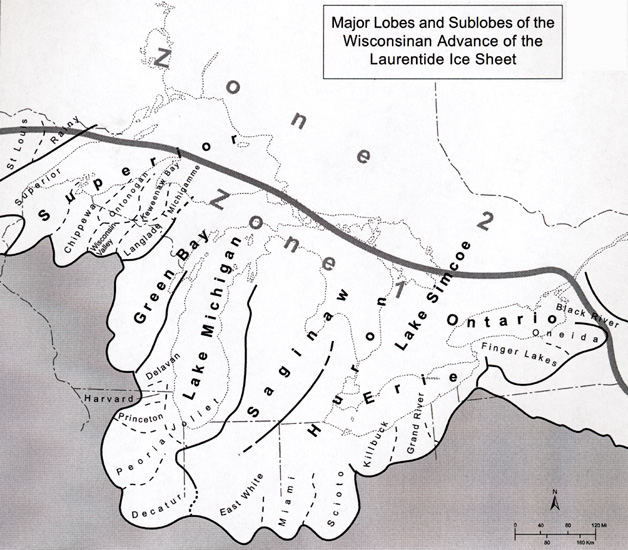
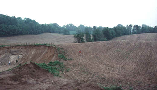
The interlobate moraine formed at the contact is a long mass of hills, lakes, sand and
gravel. Short, steep slopes are the rule in such landscapes, and it is safe to
assume that sediments and soils are extremely variable over short distances, with sandy
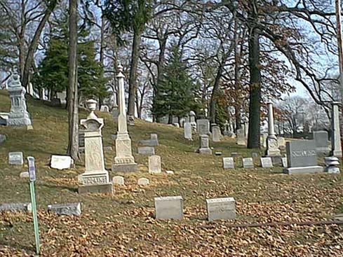
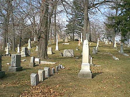
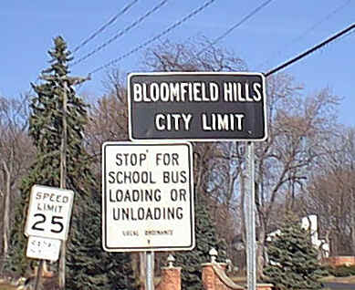
and gravelly soils dominating. Such landscapes make good cemeteries, like the one
below in Bloomfield Hills!
This interlobate region contains, in its southern end, the region known as the Irish
Hills.
Cities located in the SE Michigan's interlobate region include:
Pontiac, Auburn Hills, Walled Lake, Brooklyn, Brighton, Pinckney, Bloomfield Hills, and
West Bloomfield Township.
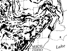
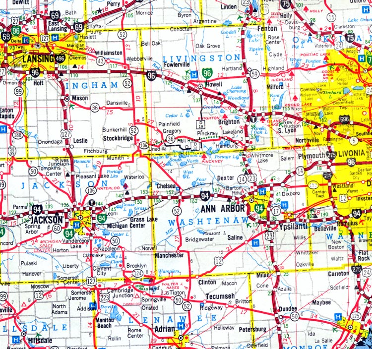
The map below is from the SE Michigan interlobate region: most of the lakes you see are
kettle lakes. The interlobate region runs from the NE part of the map to the SW
corner.
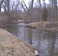
What do these landscapes look like? They are usually quite hilly and rolling, and
because of the many steep slopes and wet areas, they are often quite heavily forested.
Many streams and lakes occur in this hilly, sandy landscape.
This material has been compiled for educational use only,
and may not be reproduced without permission. One copy may be printed for
personal use. Please contact Randall Schaetzl (soils@msu.edu)
for more information or permissions.