CLOUDINESS
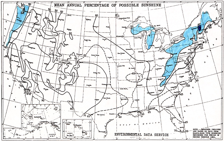
Michigan residents often joke or complain about how
cloudy the state is. The map below shows that, on an annual basis,
it really is a cloudy place. Areas
downwind (east of) the Great Lakes are the most cloudy, due to the
evaporation of water off the lakes' surface. These areas receive
only 50% or less of the total possible sunshine, meaning that they are
cloudy about half or a little more than half of the time.
Click here for
full size image (275 kb)
Source: Unknown
This material has been compiled for educational use only, and may not be reproduced without permission. One copy may be printed for personal use. Please contact Randall Schaetzl (soils@msu.edu) for more information or permissions.