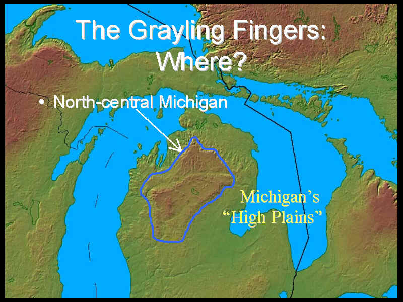
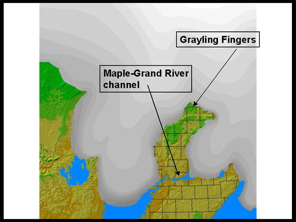
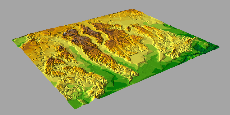
The Grayling Fingers are part of Michigan's "High Plains". The fingers themselves are north-south trending ridges composed of sand and gravel, deposited by glacial meltwaters flowing out from the Saginaw and Lake Michigan ice lobes.
History
In the 1850's the "land lookers" were busy in the High Plains area locating and
filing on the choice timber acreage. There were still no settlements in the pine country
except along the lake shore but the Land Office Survey had been through the country and
had marked the township and section lines. Occasionally two parties of "lookers"
would meet in choice timber country and a spirited race would follow, the destination
being the Land Office at Ionia, two hundred miles south.Previous to 1820 the price of
public lands at the Land Office was $2.00 per acre, on the installment plan, 50 cents down
and 50 cents per year. In 1820, due to the "cost and difficulties of collecting
arrears" and "to check speculation," the policy was changed to that of the
sale in 80 acre plots at $1.25 per acre, for cash.
A lively speculation in timber lands grew up, although most of these
were beyond the reach of lumbering for the time being. At the price of $1.25 per acre
there was heavy profit in the timber lands. The average yield of timber from the Michigan
pine lands was 5,000 board feet at an average stumpage value of $3.00 per thousand. In
addition these early lands were not average, some of those on the western side of the High
Plains yielded almost 30,000 board feet per acre. A township near Houghton Lake was sold a
few years later for $100,000, which was probably less than half the stumpage value of the
timber on it. The pine of Michigan made more millionaires than the gold of California.
The earliest lumber operations in the High Plains were along the
principal rivers, especially the Au Sable, Manistee, Muskegon and their tributaries. From
Saginaw Bay the mill owners had extended their operations up the east coast. In 1863 Loud,
Gay & Co. had a mill at Oscoda at the mouth of the Au Sable and owned sixty thousand
acres of pine along this stream. There was a mill at Alpena as early as 1860 drawing upon
the timber up the Thunder Bay river. On the western side, logs had been driven down the
Muskegon for shipment to Chicago in 1839 and there were mills at Muskegon and at the mouth
of the Manistee by 1850.
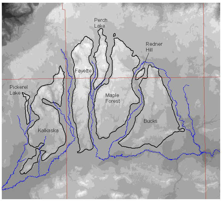
Grayling Fingers' names (after Schaetzl) on a digital elevation model background
This material has been compiled for educational use only, and may not be reproduced without permission. One copy may be printed for personal use. Please contact Randall Schaetzl (soils@msu.edu) for more information or permissions.