LAKE EFFECT SNOW
Climatic "lake effects" stem from the water surface that the lakes expose to the
atmosphere and from the contrasting physical properties of land and water. The
lake-vs-land contrasts can result in pronounced surface temperature gradients at
shorelines. The most widely known climatic influence of the Great Lakes involves lake
effect snowfall. However, the lakes influence many other aspects of climate, including air
temperature, summer precipitation, cloud cover, and local winds.
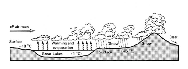
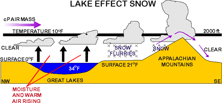
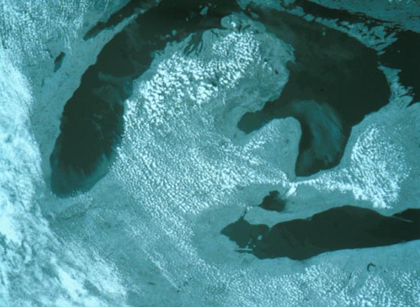
As cold arctic air masses sweep over the lakes, they warm from below
and become saturated. The unstable, saturated air rises and may produce heavy showers of
"lake effect snow".
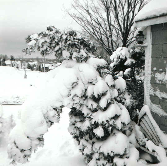
Source: Photograph by Randy Schaetzl, Professor of Geography - Michigan State University
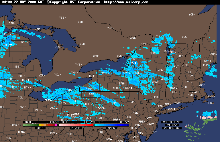
As this air moves over the lee shores of the lakes, additional lifting is provided by
low hills and by convergence as the air slows down over the rougher terrain. Lake effect
snowfall can account for 30% to 60% of the total snowfall at some locations immediately to
the lee of the lakes.
The map below shows average snowfall for the Great Lakes region, for
the years 1951-1980. The major lake effect snowbelts are clearly shown by the darker
shaded areas. The data illustrate that these lake effect belts are primarily located east
or south of the Great Lakes.
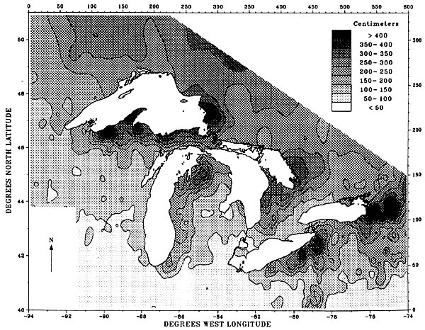
Source: Norton, D.C. and S.J. Bolsenga. 1993. Spatiotemporal trends in lake effect and continental snowfall in the Laurentian Great Lakes, 1951-1980. J. Climate 6:1943-1956.
One of the major mechanisms whereby air is lifted, and lake effect precipitation is formed, is called "convergence uplift". This type of lifting occurs as air moving across the smooth water body (lake) encounters the rougher land mass. The air then "piles up" on the lee shore zone, and is forced to rise. This rising action sparks much of the lake effect snow near the lee shores of the Great Lakes.
A second type of uplift, orographic uplift, occurs where air is forced over high land masses. The air rises, and precipitation is forced to fall from it. In Michigan, major areas of orographic uplift, and hence heavy snowfall, are the Huron Mountains, the Peshekee Highlands, and the spine of the Keweenaw peninsula (in the UP), and the Gaylord-Grayling area (lower peninsula). This type of uplift occurs inland, whereas convergence uplift dominates shorezone areas.
As a cold, continental air mass crosses the Great Lakes in winter, it acquires moisture and is made less stable because of warming from below. Add a little uplift (in lee locations) to this air, and heavy snows can result.
Source: Photograph by Randy Schaetzl, Professor of Geography - Michigan State University
Source: Photograph by Randy Schaetzl, Professor of Geography - Michigan State University
Source: Unknown
Click HERE and HERE to see animated radar images of lake
effect snow in Michigan and the Great Lakes region.
This material has been compiled for educational use only, and
may not be reproduced without permission. One copy may be printed for personal
use. Please contact Randall Schaetzl (soils@msu.edu)
for more information or permissions.