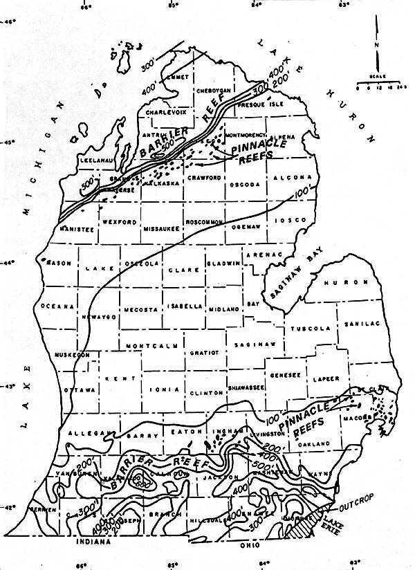
PINNACLE REEFS
During the early and middle Silurian, an extensive blanket of limestone
was deposited from New York State west --- at least as far as Wisconsin. Within this area
of carbonate deposition, however, some localities subsided much more rapidly than others.
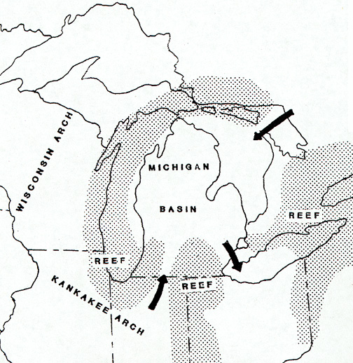
One of the areas of subsidence was located under what is now lower Michigan. Indeed, the
development of the Michigan Basin is the dominant feature developed in the Great Lakes
region during the Silurian.
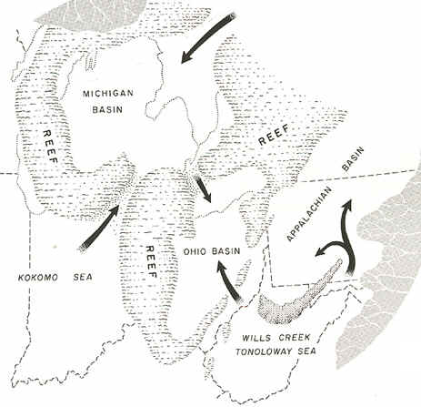
Earlier, during the Cambrian and Ordovician periods, one rather
elongate basin extended from Missouri northeastward through Illinois and lower Michigan.
This basin was bounded on the northwest by the Wisconsin Arch and on the southeast by the
Cincinnati Arch. During the middle Silurian the Kankakee Arch developed across
northeastern Illinois, forming two separate basins. Although it did not form a land
barrier, it greatly restricted circulation of sea waters within the Michigan Basin.
The rate of subsidence within the Michigan Basin then increased
markedly, and a series of coral reefs developed along the Kankakee Arch and in the shallow
waters along the western and southern margins of the basin.
Source: Unknown
Source: Unknown
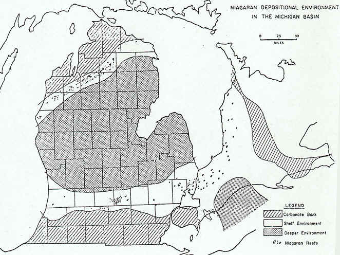
Some of these reefs can be seen today on the south side of Chicago, and I-94 crosses over a giant quarry into one of them. Assuming that the Silurian reefs formed in an environment similar to modern reefs, we can infer something about the Great Lakes area during this time. All modern reefs grow on a shallow bottom, no deeper than the depth of light penetration (generally about 60 m). Furthermore, coral reefs are restricted to tropical regions where water temperatures are consistently above 77oF. Thus, the presence of extensive reefs around the Michigan Basin during the Silurian suggests a shallow tropical or sub-tropical environment.
Source: Unknown
Well-preserved fossils in most of these ancient reefs substantiate this assumption. Outward from the reefs, in the deeper water, muds rich in CaCO3 accumulated on the floor of the vast shallow seas, generally producing thinly bedded dolomite that contains few fossils. Thus, visualize a subsiding, circular basin in lower Michigan, surrounded by shallow waters and coral reefs.
Source: Unknown
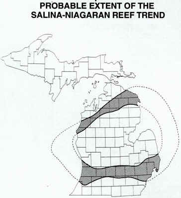
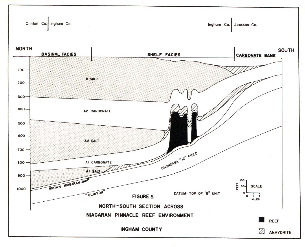
Meanwhile, in shallower waters, carbonate bank (shelf) deposits were being formed (landward of the pinnacle reefs) (see below).
Source: Unknown
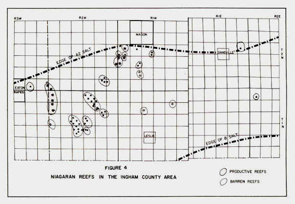
The southern "arm" of the pinnacle reef belt crosses through Ingham County, in
the Mason-Dansville area; some oil has been extracted from these reefs.
Source: Unknown
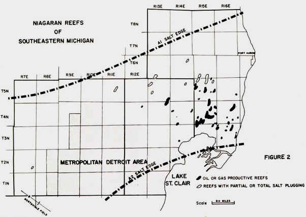
Similarly, reefs in SE lower Michigan (St. Clair and Macomb Counties) have also been
productive hydrocarbon sources.
Source: Unknown
Source: Unknown
Click here to go to the remaining part of this
page on pinnacle reefs.
This material has been compiled for educational use only, and
may not be reproduced without permission. One copy may be printed for personal
use. Please contact Randall Schaetzl (soils@msu.edu)
for more information or permissions.