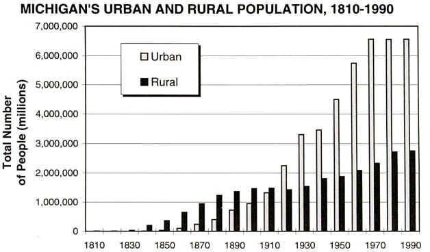
POPULATION CHANGES
In 1810, 4762 people lived in Michigan territory. By 1820, the population
was 8096, and the three largest towns were Detroit, Mackinac, and Sault Ste. Marie. By
1850, 34% of the population was from New York state (immigrants). In the late 1800's, with
the birth of the auto and the Industrial Revolution, the trend moved from a predominantly
rural population to a mostly urban one. By 1930, 68% of the population was urban, compared
to 68% rural 50 years earlier. By the 1970's the trend was toward an urban exodus and a
move to the suburbs.
Source: Unknown
This urban-to-rural trend (suburbs are essentially rural) was facilitated by affordable
automobiles, cheap gas, cheap rural land, better salaries at factories, and improving road
conditions, as well as manufacturing firms that were relocating to the suburbs. Michigan
fever in the 1830's was fueled by good land and the Erie Canal, but it was extended due to
the copper boom of the 1840's and the iron ore boom shortly after that. In 1838, the
furniture industry began in Grand Rapids, as small lumber mills began dotting the
landscape. The urban growth in the late 1800's was fueled more by immigrants moving into
Michigan’s cities directly, than it was by in-state people relocating to cities. The
urban to rural migration has been termed the "rural renaissance". Out-migration
from 1970-90 totaled nearly a million people, or 10% of the 1970 population. Why? 1980's
recession and loss of jobs.
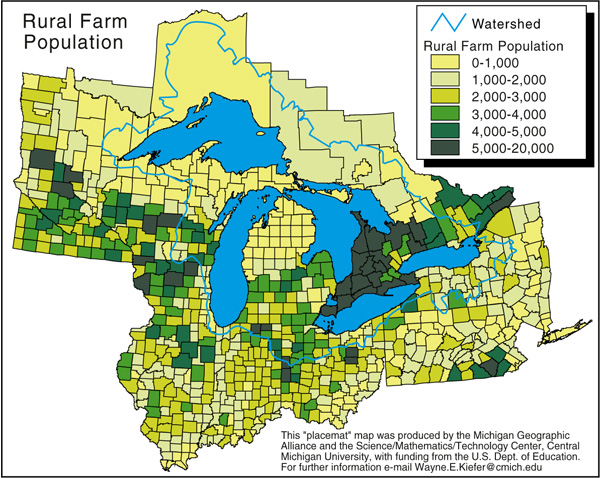
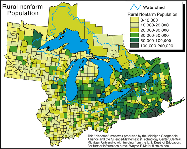
Currently, Michigan's population can be divided up into Farm and Non-Farm
segments. These segments are distributed as shown below.
Projected changes in Michigan's population are shown on the map below.
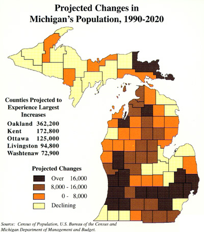
This "placemat" map was produced by the Michigan Geographic
Alliance and the Science/Mathematics/Technology Center, Central Michigan University, with
funding from the U.S. Dept. of Education. For further information email Wayne.E.Kiefer@cmich.edu
Similar data can be generated for population density.
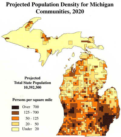
This "placemat" map was produced by the Michigan Geographic
Alliance and the Science/Mathematics/Technology Center, Central Michigan University, with
funding from the U.S. Dept. of Education. For further information email
Wayne.E.Kiefer@cmich.edu
Note that the most densely populated parts of the state are near the major urban areas:
Detroit, Grand Rapids, Flint, and Lansing.
This material has been compiled for educational use only, and
may not be reproduced without permission. One copy may be printed for personal
use. Please contact Randall Schaetzl (soils@msu.edu)
for more information or permissions.