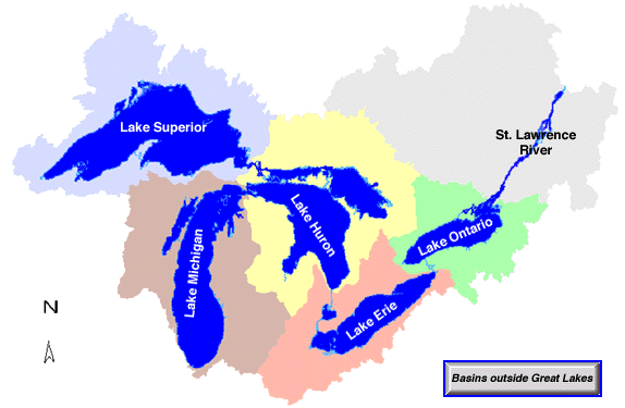
Michigan is called the Great Lake State because it borders on four and controls the area of much of the five large lakes that are collectively called the Great Lakes. The lake basins were eroded more than 10,000 years ago, and taken together, they contain the largest volume of freshwater in the world. The waterways connecting them form part of the largest inland water transportation route, the St. Lawrence Seaway.
Lake Superior, the largest of the Great Lakes, has a water surface area of 82,100 sq km and a maximum depth of 406 m. The surface of Lake Superior is large enough to contain the land area of the states of Connecticut, Delaware, Hawaii, Maryland, and New Jersey combined. Lake Huron is the second in size with 59,700 sq km; Lake Michigan, third, with 57,750 sq km; and Lake Erie, fourth, with 25,700 sq km. These lakes provide important water connections between these ports of Michigan, and between these ports and other ports of the United States, as well as of the world. The four lakes represent a freshwater resource for domestic and industry use for many communities along the coast and those that can be reached by pipelines. The commercial fishery resources of the lakes are considerable but have been decreasing in recent years. Fishing for coho and chinook salmon, first introduced into the lakes in 1966 is now a major sports activity on the lakes and in the adjoining rivers. Commercial fishing is handicapped by the fact that there is too high a concentration of undesirable chemicals in a number of fish species, particularly the salmon and lake trout.
The Great Lakes' watershed, also shown on GEO 333's title page, is composed of many sub-watersheds. On the north side, waters are clearer and colder, coming from the forests of the Canadian Shield. On the south, agriculture and industry provide sediment and other forms of pollution to the rivers that drain into the lakes.
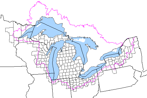
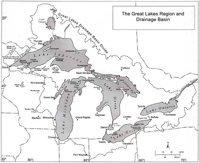
The map below shows not only the Great
Lakes region but also some of its major cities and physical features.
Parts of the text on this page have been modified from
L.M. Sommers' book entitled, "Michigan: A
Geography".
Islands
The 35,000 islands of
the Great Lakes form a superlative natural system. In fact, the largest
lake island in the world is Manitoulin in Lake Huron (Ontario), covering
1,068 square miles. Due to their isolation, islands have unique properties
warranting special attention and protection. The properties of Great Lakes
islands include high proportions of endemic and endangered species, fish
spawning areas, open and perched dunes, and nesting colonial waterbirds
and migratory waterfowl. These islands contain many critical natural
features, cultural resources, and recreational opportunities that, despite
being threatened by pressures of unplanned development and habitat
destruction, have yet to be holistically addressed.
Selected Islands of the Great Lakes
Basin
Island or Group
Lake/Strait
Comments
Apostle Islands Superior National Lakeshore Park, remnants of pre-glacial hills.
Bass Islands Erie Perry's victory and International Peace Memorial.
Beaver Michigan Historic kingdom of James Strang -- ferry service.
Belle Isle Detroit Continent's most used and largest urban island park.
Bois Blanc Huron 13,000 acres; 25 deer per mi2, 40 inland lakes.
Drummond Huron Recreation, mining.
Fox Islands Michigan Deer herd management is a concern.
Green Bay Islands Michigan Border established by decision of US Supreme Court in the 1920's.
Grosse Isle Detroit Upper class residential area; industrial waste site.
Harsens St. Clair Seasonal homes, water fowl hunting.
Isle Royale Superior Largest island in lake, National Park, no motors, frequently mislocated.
Mackinac Huron Historic fur trade center and fort, State Park, ferry, no motor vehicles. Tourism.
Manitou Islands Michigan Part of Sleeping Bear Dunes National Lakeshore Park. Named for Indian word "Great Spirit".
Manitoulin Huron Largest island in the Great Lakes Basin, bridge and ferry service, seasonal recreation homes. On Niagara cuesta.
Michipicoten Superior Forested and largely uninhabited.
Neebish St. Mary's Small island in the river. USA territory.
St. Ignace Superior Aesthetic beauty.
St. Joseph St. Mary's Amerind settlement. Canadian territory.
Sleeping Giant Superior Spirit of Anishinabe.
Sugar St. Mary's Amerind settlement. USA territory.
Thirty Thousand Islands Georgian Bay Boat tours. Great vacation sites. Mostly limestone.
Walpole St. Clair Amerind settlement, outdoor recreation.
More Great Lakes island facts:
The 30,000
Islands of Georgian Bay, Ontario, actually include only several thousand
islands. The Thousand Islands between New York and Ontario number
about 1,500. Lake of the Woods, shared by Ontario, Minnesota and
Manitoba, is said to contain 14,000 islands. Finland claims to have more
islands than any other country, with a stated total of 179,584. However,
Canada probably exceeds this number with its immense areas of
island-strewn lakes and thousands of miles of rocky coastline. The
largest island created by human action is the Ile Rene-Lavasseur, a
780-square-mile island in Manicouagan Reservoir, Quebec. The reservoir was
formed by the damming of a river to flood a 210 million-year-old meteor
crater. The crater's central uplift became the island.
This material has been compiled for educational use only, and may not be reproduced without permission. One copy may be printed for personal use. Please contact Randall Schaetzl (soils@msu.edu) for more information or permissions.