Many retreating ice sheets had, at one time or another, water ponded in front of their margins. Some of the later, major lakes that existed in the region are shown below. For more detail, go to the glacial lakes page.
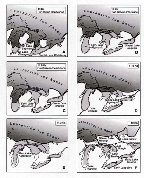
These proglacial ("pro-" = "in front of") lakes occur when the land surface slopes toward the retreating ice margin, trapping meltwater in water bodies. Proglacial lakes are ephemeral features, and eventually drain after the ice is gone, although some last for thousands of years. Michigan had several large proglacial lakes that impacted our landscape. Beneath these lakes flat, expansive glaciolacustrine plains developed, such as in the Toledo and Saginaw areas.
The flattest areas of Michigan are plains that are the result of deposits on the bottom of glacial and proglacial lakes; the area involved depends on the size of the original lake. Lake Erie and Saginaw Bay on Lake Huron were once much higher and extended inland, and what was once part of the bottom of those bodies of water now makes up the lacustrine plains near Saginaw and Monroe. In both of these cases, specialized crops now flourish-navy beans and sugar beets in the Saginaw Valley, and soybeans, and intensive farming south of Detroit to the Ohio border.
One interesting landscape in our state includes the broad expanse of level lands from the Ohio boundary around "the Thumb", in the Saginaw Basin bounding lakes Erie, St. Clair, and Huron, scattered flat lands bordering Lake Michigan, the flat plains of the Ontonagon valley, and the marshy lowland of the watershed of the Tahquamenon and Manistique rivers. Long ridges of sandy gravel interrupt what would otherwise be great expanses of flat land. Many sand dunes occur along their inland slopes far from any body of water. As we cross the level lands we find they are actually terraces leading down to the Great Lakes, each terrace separated from its neighbor by a high or low steep cliff. These lands have areas of heavy clay interspersed with stretches of water-washed sand and gravel. They were once lake beds; the ridges of gravel were beaches; the flat stratified sand and gravel plains and clay plains with a veneer of sand or gravel were fillings of old bays of ancient long-departed lakes and the deltas of rivers flowing into them. Each of these glacial lakes had a name. The level plain from Seney to Shingleton, Schoolcraft County, was the bed of Lake Algonquin. The swamps of the Northern Peninsula are the remnants of that lake.
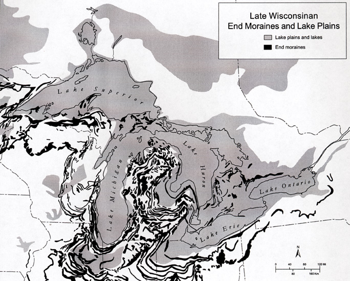
Many parts of Michigan were covered by ponded water during the retreat of the last ice sheet--the Wisconsinsan ice sheet. These lake plains came into existence because the land sloped toward the ice margin, and water ponded between the high ice sheet and the high lands to its south. The areas in gray on the map below show the many areas of lake plain (correctly termed "glaciolacustrine plains") that exist in our region.
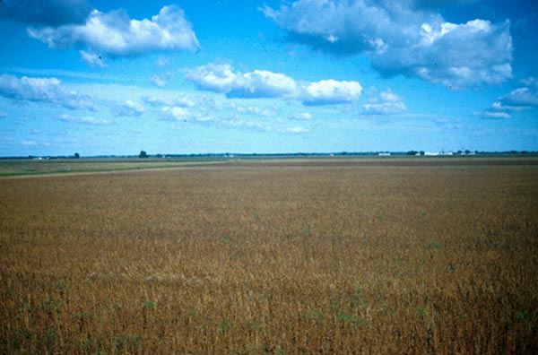
Glacial lake plains are generally flat. The lack of topography is due to two differing, lake bottom processes: (1) infilling of deep parts of the lake with clays and silt, and (2) beveling of the shallower parts of the lake by waves. The image below shows the flat plain of Glacial Lake Saginaw, near the town of Swan Creek.
Marl deposited in the glacial lake beds is used for cement and fertilizer. Three cement plants in the State, at Coldwater, Fenton, and Cement City once operated wholly on marl. The marl comes from thick deposits in kettle lakes in the nearby moraine; soundings show that some of the beds are at least 25 m thick.
This material has been compiled for educational use only, and may not be reproduced without permission. One copy may be printed for personal use. Please contact Randall Schaetzl (soils@msu.edu) for more information or permissions.